ANTIQUE CARD & TABLE GAMES

Linen and Paper Table Games / Maps & Travel / 1760 – 1850

1845 - Astronomical Recreation - John Betts

1845 – Astronomical Recreation,  published by  John Betts 115 Strand


The slipcase shows a coloured lithograph by the Leighton Brothers, from the cover of an educational game, showing a family examining a star chart and relating it to the night sky. 

This print relates to a set of identification cards produced to instruct people in the recognition of star patterns in the sky. 

The game does not include the planet Neptune that was found in 1846

Astronomical Recreation – Condition: Slipcase is very good scuffed at the edges / Rules – Photocopy / Playing Sheet – odd very small spots and very light foxing.

Postage / As postage often changes it will be provided at time of purchase. Postage will be at cost rounded up to the nearest £1.00 to cover packaging.

REF:LBG104z

£ 950

CLICK IMAGE FOR A LARGER PICTURE

1768 - Royal (The) Geographical Pastime or the complete Tour of Europe - Jefferys

The Royal Geographical Pastime exhibiting the Tour of Europe Printed & Sold by Wm. Faden Charing Cross.

The earliest dated  game known, also of Europe,  was invented and sold by John Jefferys, at his house in Chapel Street and printed for Carrington Bowles, Map & Printseller, N° 69 in St. Paul’s Church Yard in 1759. 

This game appeared nine years later in 1768, by Thomas Jefferys, Geographer to the King.
Although published in 1768, the latest date in the game text is 1758, against St. Malo (85), Cherburg (88) and Carrickfergus (92).

The game starts at Dover and ends in London, passing through Iceland, Russia,  Asia Minor Africa and Malta.  

The Royal Geographical Pastime – Condition – The sheet is a little grubby and there are some light marks on one side – The picture shows this well – / Rules are on the sheet / Slipcase – good but a little grubby.

Postage / As postage often changes it will be provided at time of purchase. Postage will be at cost rounded up to the nearest £1.00 to cover packaging.

REF: LBG173

£ 1,600

CLICK IMAGE FOR A LARGER PICTURE

Royal Geographical Amusement or the Safe and Expeditious Traveller through all the Parts of Europe by Sea and by Land 1774 (1787) - Sayer

Royal Geographical Amusement, or the safe and expeditious Traveller through all the Parts of Europe by Sea and by Land: an instructive game.

Calculated for the Improvement of the Young Learners of Geography by Dr. Journey.

Although dated 1787 in the imprint, the letterpress text has been revised, referring to the fall of the Bastille in 1789,

Also

80 reads, “Stockholm, the capital of Sweden. Stay here two turns to view the tomb of Gustavus IIId. King of Sweden, who was shot at a masquerade on the 29th of March 1792, by one of his own discontented officers; for which villanous [sic] act he had his head and right hand cut off.”
It was originally published by Robert Sayer in 1774.
Laurie and Whittle succeeded Sayer in 1794 and were in turn succeeded by R H Laurie in 1813. It would appear that the game is an impression from the original plate with the lettering altered.

Royal Geographical Amusement – Condition – Sheet is lightly foxed, / rules are on the sheet / slipcase is good.

Postage / As postage often changes it will be provided at time of purchase. Postage will be at cost rounded up to the nearest £1.00 to cover packaging.

REF: LBG178

£ 1,200

CLICK IMAGE FOR A LARGER PICTURE

Wallis's New Geographical Game Exhibiting a Voyage Round the World 1796

Wallis’s New Geographical Game Exhibiting a Voyage Round the World 1796 – A New Geographical Pastime.

Published Jan 20th 1796 by John Wallis at his Map Warehouse No 16 Ludgate Street.  Printed for John Wallis at his wholesale repository 13 Warwick Square London
by T Sorrel, Bartholomew Close, Smithfield.

Undated but with the long S, that the later versions (1802) does not have.
In a slipcase dated 1802, so it may have been sold initially without a slipcase and then the style updated, or it could have been put into the slipcase at a later date.

It is a coloured engraved double hemispherical map.
It shows how little appears to be known about Africa at that time
ie Guinea ..of which little in known to Europeans.”

There is information about New Holland (Australia) – The largest island in the world
With a number of references to Captain Cook’s journeys

59 – Bhering’s Straits – also called Cook’s Straits
60 – Cook’s River on the north west coast of America so called from its discoverer, Capt Cook
61 – NootkaSound – discovered by Capt. Cook
Back to New Zealand
91 – Cook’s straights
92  – New Hebrides – visited by Cook in 1774
93 – Friendly Isles so named by Capt Cook in 1773
94 – Owhhyee – the largest Sandwich Island, here the traveller must stay a turn to view the bay where Capt Cook was unfortunately killed in a contest with the natives, 14th February 1779
97 – “Cook’s ne plus ultra” – Capt Cook being prevented from going further south by immense fields of ice

Condition – Voyage Round the World / Slipcase – good engraved picture – scuffed and rubbed at the edges / Playing sheet – this is very good – clean and bright – well colored. / Rules – at base of playing sheet. These appear (in all versions we have seen) to be a separate piece on paper added to the game. This was presumably to keep it updated without reprinting the map.

There is a slight difference in the punctuation, as well as the change to the letters ie no long S to the version printed by J Crowder and E Hemsted in 1802.

Postage / As postage often changes it will be provided at time of purchase. Postage will be at cost rounded up to the nearest £1.00 to cover packaging.

REF: LBG617

£ 1,500

CLICK IMAGE FOR A LARGER PICTURE

1809 - Geographical recreation, or a voyage round the habitable globe, J Harris

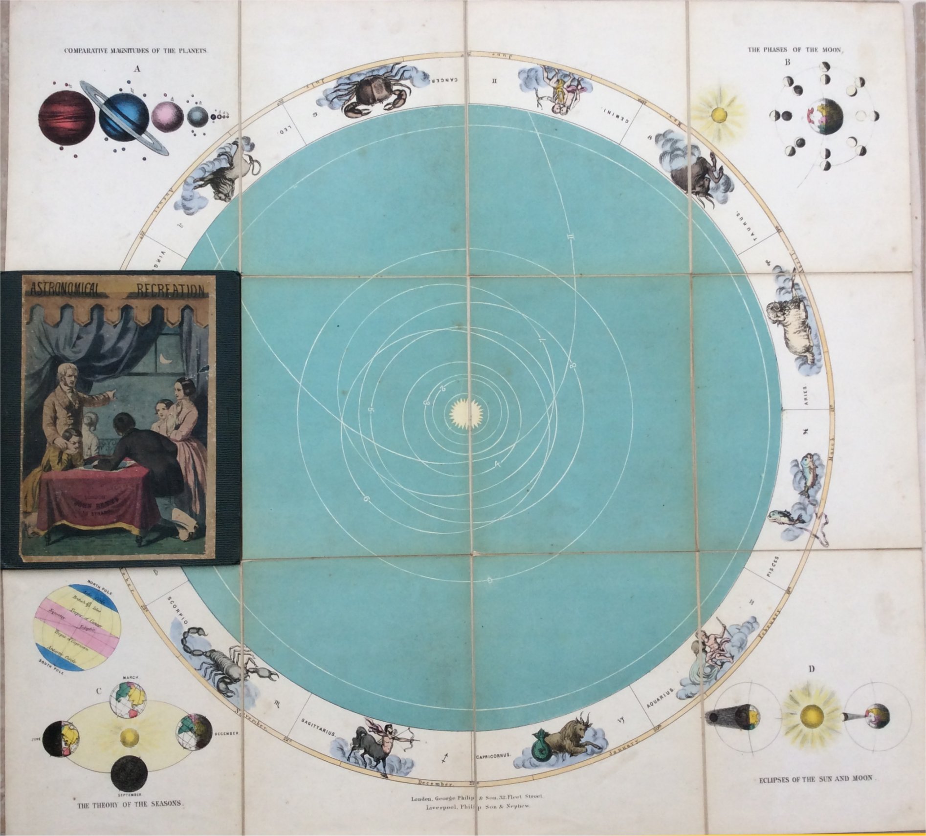
A voyage round the habitable world : a new game exhibiting the manners, customs, and dresses of the various nations of Europe, Asia, Africa and America : to which is appended a synopsis of geography.

London : Printed for J. Harris, Juvenile Library, corner of St. Paul’s Church Yard, 1809

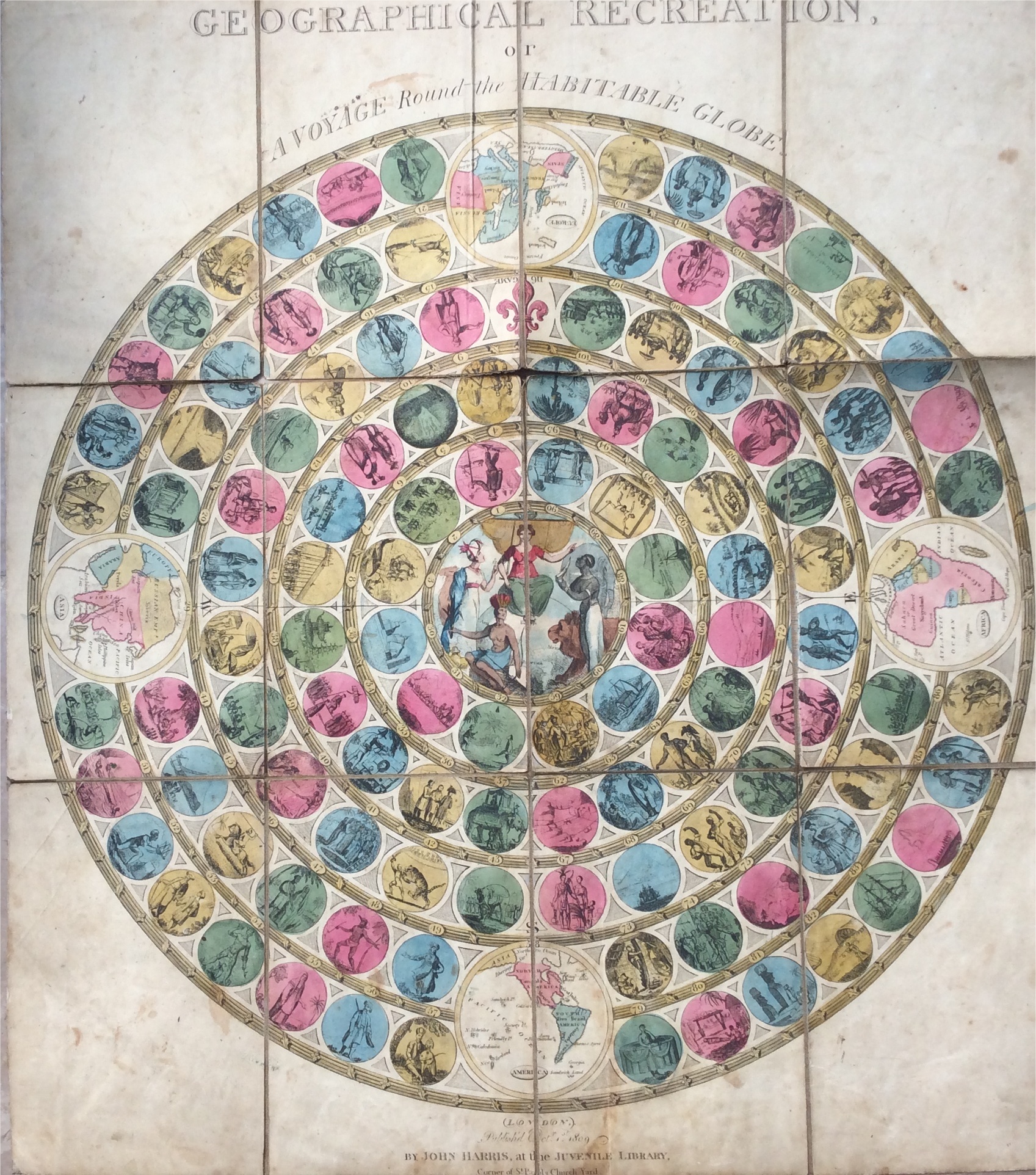
The game follows through 115 medallions in pink, yellow, blue, and green, grouped by continent in five concentric tracks, lead out from the centre medallion; ie No 1 is at the centre and

Sketch maps of the four continents at each point of the compass,

Separate four sets of numbered medallions that have to be traversed in turn to reach the end of a player’s journey,

“The Return to Europe” illustrated in a medallion containing a large pink fleur-de-lys that is placed above the map of Europe, marked ‘116, Game. ‘

The ideas for geographical games are summed up in a statement in the booklet of Geographical Recreations or A Voyage around the Habitable Globe, 1809.

“The game, consisting of 116 little prints of the most interesting objects in Geography, is designed to familiarise youth with the names and relative situations of places, together with the manners, customs and dresses of the different nations in the habitable globe; and, as curiosity will naturally be excited by the scenes which present themselves, and the observations likely to occur, it is presumed that these, with an occasional reference to the Synopsis herewith given, will prove a continual source of amusement to young people of both sexes, and will furnish such a fund of geographical knowledge, as may prove equally beneficial in reading and conversation.”

This statement shows the high hopes that many publishers had for their games.’ [Goodfellow]

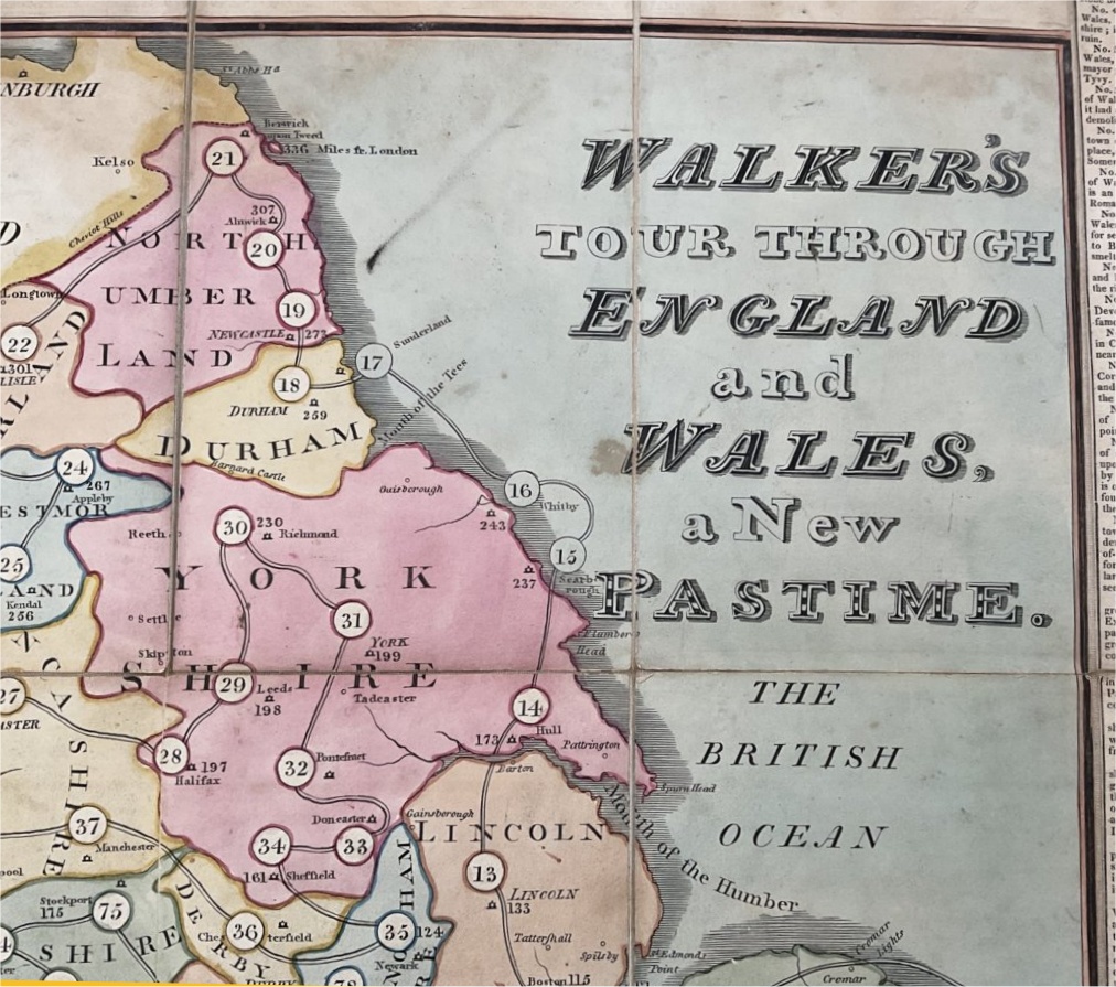
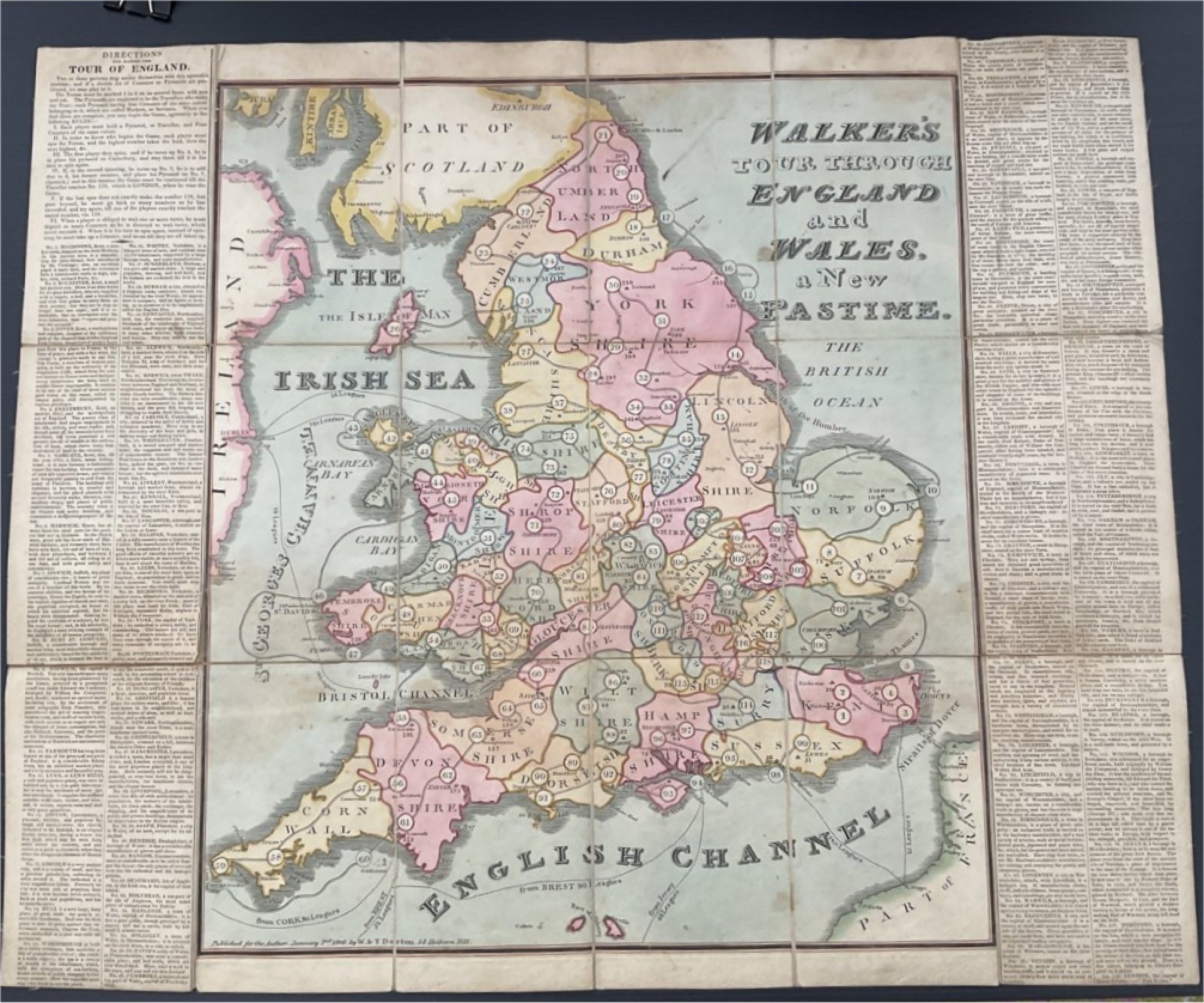
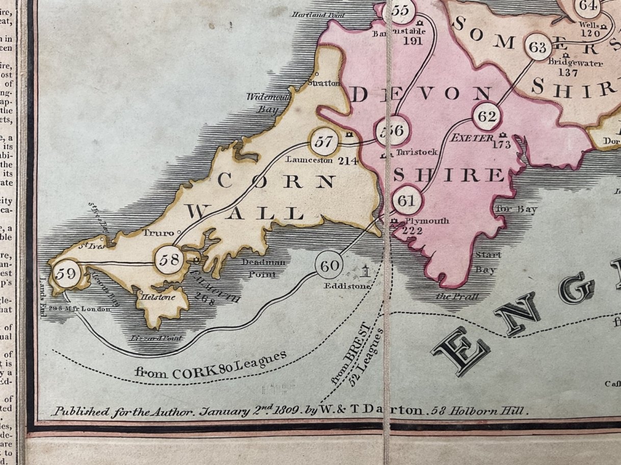
Condition / Sheet only – paper separating from sheet along top horizontal fold – Grubby / rules available at http://www.giochidelloca.it/

Postage / As postage often changes it will be provided at time of purchase. Postage will be at cost rounded up to the nearest £1.00 to cover packaging.

REF: LBG301

£375

CLICK IMAGE FOR A LARGER PICTURE

1811 - Tour through the United Kingdom of England, Scotland and Ireland - John Wallis

This is described as “Wallis’s Tour through the United Kingdom of England, Scotland and Ireland.

A New Geographical Game, Comprehending all the Cities, Principal Towns, Rivers in the British Empire” (first page of instructions has as title “Wallis Tour through the British Empire”).


Condition – Playing area slightly dusty but good and undamaged / Rules – Photocopy / In original bookstyle case.

Postage / As postage often changes it will be provided at time of purchase. Postage will be at cost rounded up to the nearest £1.00 to cover packaging.


REF: LBG401 /

SOLD / 0061


CLICK IMAGE FOR A LARGER PICTURE

c1820 -Walker's Tour through England and Wales

Walker’s game Tour’s through England, is a hand coloured engraved map,  mounted on linen, explanations and directions pasted to left and right margin – dated   2nd January 1809.

This version was print post 1820, despite the date on the sheet.  Under item no.115 Winsor it refers to “the late King George III”.

John Walker was a physician, geographer and engraver who designed this game map through England and Wales.

The publishers, William and Thomas Darton, were prominent in the field of children’s educational games and puzzles and operated their business from Holborn Hill when they first published this game map in 1809.

This game map allows players, or “travellers” to traverse England and Wales, starting in Maidstone Kent and finishing in London, the 118th stop on the board.

Condition – No slipcase – rules on the sheet. slightly grubby 

Postage / As postage often changes it will be provided at time of purchase. Postage will be at cost rounded up to the nearest £1.00 to cover packaging.

REF: MISC400

£475

CLICK IMAGE FOR A LARGER PICTURE

1824 - The World - E Wallis

This is a decorative racing game around both hemispheres of The World.

The game itself has small globes representing latitude, longtitude, zones, circles and characteristics.  It is a different game to the John Wallis game that was published in 1797.

Paris now features as the place where Louis XVI was beheaded, but Australia still remains known for the convicts settlement.

Captain Cook is still featured strongly. There is more information about North America than in earlier games.


Two copies of a dissecting puzzle made from this sheet (or vis a vers) are known dated 1812 and 1820. According to The New York Library 3 editions were published in 1824 by Wallis, E., (42 Skinnner Street & 14 High Street Islington – (1817 1847)).   This game has 6/7/1816 hand written on the back of the sheet

The World – Condition:   Hard Slipcase in very good condition / Rules photocopy / Playing sheet is very good, slight foxing but brightly colored – no damage.

Postage / As postage often changes it will be provided at time of purchase. Postage will be at cost rounded up to the nearest £1.00 to cover packaging.

REF: LBG108

£ 900

CLICK IMAGE FOR A LARGER PICTURE

1816 Walker's Tour through France, being a New Geographcal Game.

A tour of France from Calais (1) to Paris (199) – not the most direct route!

Condition – Tour of France / sheet only – very good condition – no damage just a little light foxing (LHS). Back is shaded (but this appears to be due to the absorbance of the paper as the shape match the regions)

Postage / As postage often changes it will be provided at time of purchase. Postage will be at cost rounded up to the nearest £1.00 to cover packaging.

GO TO TO

REF: LBG601

£ 500

CLICK IMAGE FOR A LARGER PICTURE

1791 - The Royal Genealogical Pastime of the Sovereigns of England - Newbery & Wallis

The Royal Genealogical Pastime of the Sovereigns of England
from Egbert to George the 3rd.
Printed in London for Newbery & Wallis, 1791

The Utilities of the Game state “this being a scientific game, in which the amusement and Instruction of the parties are equally considered….this, while it will amuse, will not a little contribute to make the Players acquainted with the Genealogy of their own King”.

Playing The Game – When you land on a space, you then read the details, on the sheet, about the monarch and whether they were regarded as good or bad (or neutral). Your move depends on the monarch landed on, and the game’s view of them

Henry VIII – “as the treatment of his queens was so unjustified, the player must go back to No 1”

Edward III – “was a great and valiant prince, the player moves forward two numbers”

Condition – Sheet – undamaged, well colored and clean; some foxing and a stain on the right hand rules (about 5cms by 5cms) / Rules and descriptions all on the sheet – easy to read (with long S) / Slipcase – Good; scuffed but complete with label / Sheet and slipcase both dated 30th Nov 1791

Postage / As postage often changes it will be provided at time of purchase. Postage will be at cost rounded up to the nearest £1.00 to cover packaging.

REF: LBG617

£ 475

CLICK IMAGE FOR A LARGER PICTURE

1820 - Historical Pastimes - George IV- E Wallis & J Harris

Historical Pastime or a New Game of the History of England from William the Conquest to the Accession of George the Fouth, 1820
J Harris and Edwd Wallis, London, England.

A historical race game with 133 playing spaces numbered in a clockwise direction from the Battle of Hastings [1066] to the death of Queen Caroline [1821] – horn of plenty is space 133.  The central portrait is of King George IV. 

This booklet  describes each monarch and the important incidents in their reign. 

Condition – Sheet – Paper lifting at centre fold – small tear bottom left, slightly grubby round the edges  – Picture can be enlarged to see condition /  Case complete – small split a front right grubby around the top / Rules booklet – good – sewn at back to keep it together

Postage / As postage often changes it will be provided at time of purchase. Postage will be at cost rounded up to the nearest £1.00 to cover packaging.

REF: LBG301

£275

CLICK IMAGE FOR A LARGER PICTURE

c1830 - Historical Pastimes - William IV- E Wallis & J Harris

Historical Pastime. A New Game of the History of England [from William 1st to William 4th], 1831 – Edwr Wallis, J Harris

Game has 133 numbered playing spaces  depicting a horn of plenty, leading to a central portrait of King William IV.
A game devised to educate young children in some of the basic facts of English history. It was originally played with an eight-sided tetotum 1-8 and twelve letters for players 

 Condition – sheet – dusty with some minor marks, slight wear to linen where folds cross. Picture can be enlarged to see condition

Postage / As postage often changes it will be provided at time of purchase. Postage will be at cost rounded up to the nearest £1.00 to cover packaging.

REF: LBG301

£295

CLICK IMAGE FOR A LARGER PICTURE

1835 – British Sovereigns - William IV - E Wallis

This game was published (and refreshed) a number of times.

This edition features William IV and the abolishment of slavery with original rule booklet. Rare edition and only produced for a short period of time

Condition – British Sovereigns / Playing area very good clean and bright / original rule booklet / Slipcase – lightly scuffed otherwise good

Postage / As postage often changes it will be provided at time of purchase. Postage will be at cost rounded up to the nearest £1.00 to cover packaging.

REF: LBG103

£  650

CLICK IMAGE FOR A LARGER PICTURE

1840 - Amusement in English History

English History in 40 pictures from A Brition, A Roman, A Saxon, A Dan, William I thro to Victoria.
Well colored pictures

Condition – English History / Sheet is very good, clean and little sign of use / Cover (booklike, so attached) is worn and split slightly at the spine, a little grubby with odd marks – title good and clear in gold lettering / Photocopy of rules available

Postage / As postage often changes it will be provided at time of purchase. Postage will be at cost rounded up to the nearest £1.00 to cover packaging.

REF:  LBG603

£ 34o

CLICK IMAGE FOR A LARGER PICTURE

1809 - The Jubilee - J. Harris

This game was produced to celebrate George III’s fifty years as king.

The board records the major events, episodes and geographic and scientific discoveries of his rule. The 150 squares begin at the outer edge, with the proclamation of George’s reign, progressing through upheavals such as the American Revolutionary and Napoleonic wars, and ending with the Jubilee celebrations in September 1809. Pleasant and unpleasant episodes are depicted, such as the Treaty of Paris, the Stamp Tax Act and the Boston Tea Party, many in a semi-satirical cartoon style. .

It starts at October 25th 1760  when George III ascended to the throne, and covers royaly events, international events and discoveries – 150 in all, including

New Zealand explored by Captain Cook 1769
Uranus, the Greek god of the sky (The Georgium Sidus was disoverd by Herschel who tried unsuccessfully to name his discovery after King George III. Instead, the scientific community accepted Bode’s suggestion to name it) (1781)
The first balloon ascent in England (1784)
Convicts first sent to Botany Bay (1787)
Demolition of the Bastille 1789
Garnerin’s Parachute 1802
Death of lord Nelson 1806
Vaccine establishment 1809

The events are listed, with brief descriptions, on the first 12 pages

There are 40 pages describing the 150 events in more detail. 

Condition / Sheet – grubby – all four corners taped – slight tear at folds /  The Slipcase is grubby, on the back a label – “sold at M&T Webb Jr DUBLIN” /  Booklet – complete – 56 pages – the last two with adverts – cover grubby, contents complete and good 

Postage / As postage often changes it will be provided at time of purchase. Postage will be at cost rounded up to the nearest £1.00 to cover packaging

REF: LBG451

SOLD 091

CLICK IMAGE FOR A LARGER PICTURE

1829 Middleton's New Geographical Game of a Tour of England & Wales - John Harris

A tour of England and Wales Game – from Berwick to Land’s End

Condition – Middleton Tour of England / sheet only – good condition – one small tear (by the Y of Yorkshire), a couple of odd spots on the margin otherwise clean and undamaged.

Postage / As postage often changes it will be provided at time of purchase. Postage will be at cost rounded up to the nearest £1.00 to cover packaging.

REF:  LBG600

SOLD

CLICK IMAGE FOR A LARGER PICTURE